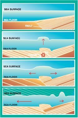
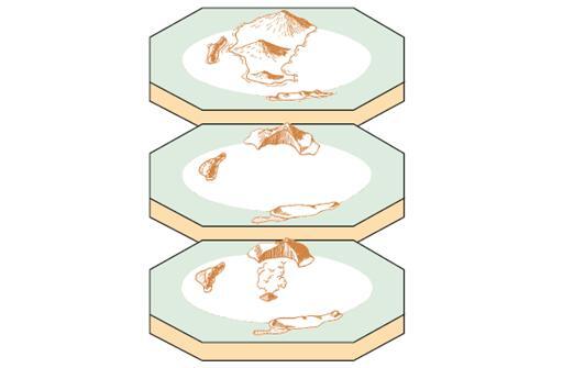
Generation of Tsunamis
Once the event which initiates the tsunami occurs the potential energy that results from pushing water above mean sea level is then transferred to horizontal propagation of the tsunami wave (kinetic energy). The return of the sea level to its normal position generates a series of waves propagating in all directions from the initially deformed area.
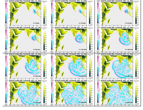
Propagation of Tsunamis The speed at which the tsunami travels depends on the water depth. If the water depth decreases, tsunami speed decreases. In the mid-Pacific, where the water depths reach 4.5 kilometers, tsunami speeds can be more than 900 kilometers per hour. Refraction and diffraction of waves are important to the tsunami propagation.
Refraction Consider progressive waves with wavelengths much larger than the water depths over which they propagate. These are called shallowwater or long waves. Because the waves are long, different parts of the wave might be over widely varying depths (especially in coastal areas) at a given instant. As depth determines the velocity of long waves, different parts travel with different velocities, causing the waves to bend, and this is called wave refraction. (Shallower the water depth, less is the velocity.)
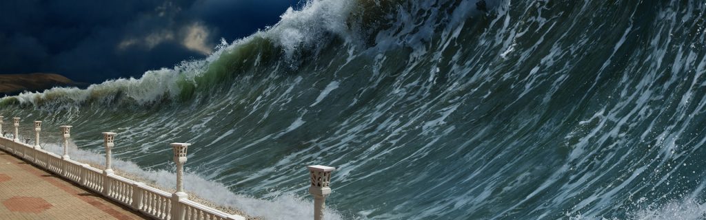
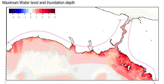
Diffraction Diffraction can be considered as the bending of waves around objects. It is this kind of movement that allows waves to move past barriers into harbors as energy moves laterally along the crest of the wave. Offshore and coastal features can therefore determine the size and impact of tsunami waves. Reefs, bays, entrances to rivers, undersea features and the slope of the beach all help to modify the tsunami as it attacks the coastline. When the tsunami reaches the coast and moves inland, the water level can rise many meters. In extreme cases, water level has risen to more than 15 m for tsunamis of distant origin and over 30 m for tsunami waves generated near the earthquake’s epicenter. Since the first wave may not be the largest in the series of waves, one coastal community may see no damaging wave activity while in another nearby community destructive waves can be large and violent. The flooding can extend inland by 300 m or more, covering large expanses of land with water and debris.